
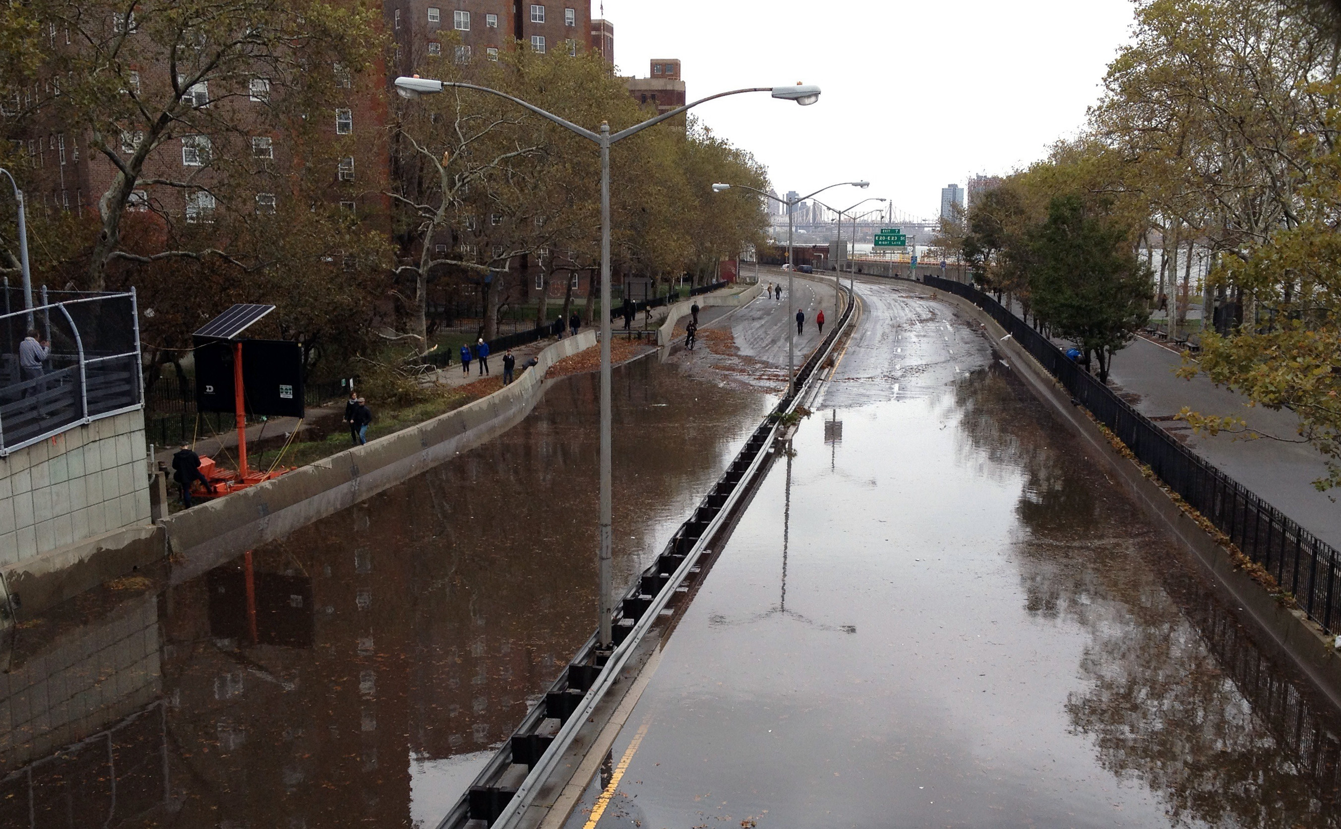
Coney Island, New York is no stranger to the destructive effects of storms, surf, and wind. The most recent one, however, was among the most memorable. Superstorm Sandy wreaked such havoc on the area that rebuilding is still underway in some places.
Undoing the damage that destroyed homes, tainted resources, and wiped out major portions of the iconic boardwalk, meant major costs to businesses, residents, and a whole lot of large timber bolts.
If you look at many parts of Coney Island today, you might never think a massive storm ripped through the area just six years ago. Recovery efforts were integral to such a restoration, but a major building boom has also spurred revitalization throughout the community.
That may sound like an ideal outcome following any significant disaster, but it can also lull locals and officials into a false sense of security. Once life returns to normal, a dangerous denial can take hold and make people forget about how quickly devastation can happen again. This is why some city planners and regional advocacy groups want to take lessons from Sandy and establish a new tact for Coney Island’s present and future developments, as well as those in neighboring coastal communities.
Using data from the New York City Panel on Climate Change (NPCC) and other resources, the Regional Plan Association (RPA) produced a report showing the need for a strategic retreat for the region’s coastal communities.
The report “Under Water—How Sea Level Rise Threatens the Tri-State Region”, warned of a one-foot rise in sea level in as little as ten years. Coastal areas across southern New York, northern and central New Jersey, and all of Connecticut could see an additional three-foot rise in water levels by 2080 and a six-foot rise by the end of the century.
With such projections, the RPA has specified steps to prevent risks and adapt to likely changes instead of simply breaking ground on new developments in the same problem zones. The organization has urged careful attention to projected sea level rise in all aspects planning for new buildings, transportation developments, and more. They also emphasize the need to lay out economic support and long-term relocation plans for businesses and residents in particularly flood-prone areas.
Though the report was released in December of 2016, it hasn’t mobilized everyone to shift their plans, including people who are most likely to be affected. For-profit developers and some New York residents appear to be quite willing to take a gamble on shrinking coastlines. According to the Department of Buildings, Localize.city, and data from FEMA flood insurance maps, 12% of new New York City construction is concentrated in high-risk flood zones.
It’s been reported that even lifelong Coney Island residents, who have experienced the devastation of Superstorm Sandy, Hurricane Irene, and other recent extreme weather episodes, feel the worst of the worst will arrive after their time.
The challenge of determining a defined plan for a strategic retreat from the coast is ever-present, as it will take multiple agencies to create and agree to a comprehensive course of action. Then there is the issue of funding to make it all a reality over the coming decades.
Beyond sea walls currently under construction and initiatives to reduce New York State’s own contribution to sea level rise and carbon emissions, it appears the region has a lot more work ahead of it, so long as it wishes to keep its people and properties above water. Hopefully, the urgency will hit home without a more severe storm than the one that crippled the city just six years ago.